Your Shopping Cart is empty.


Viewpoint on the Puponga Hilltop Track in Puponga Farm Park, between Wharariki Beach and Farewell Spit - Golden Bay, South Island, New Zealand

Large tree before sunset on Urupukapuka Island, Bay of Islands, Northland NZ

Looking north past rock formations along the beautiful Mangawhai Cliff Walk

Beautiful perspective of Ocean Beach with rocks and Bream Head in the background

Beautiful beach with golden sand and volcanic rocks on the Whananaki Coastal Trail

Overhanging cliff full of stalactites outside the cave entrance

Black Mamaku tree ferns along the river near Rawhiti Cave
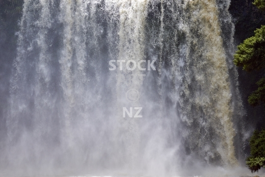
Gushing water and spray from the 26 metre waterfall in Northland, New Zealand

Beautiful lookout view with tree fern from Manaia over Taurikura and Urquharts Bay towards Bream Head

Stairway for swimmers into Potoorangi Bay in Aotea Harbour - Waikato, NZ

Black sand beach and rocks, looking out to Potoorangi Bay in Aotea Harbour - Waikato, NZ
Old lookout bench along the waterfront walk above the estuary, part of the Te Araroa Trail

Interior of the beautiful limestone cave in Dry Creek Valley with stalactites and stalagmites

Black mamaku tree fern and small waterfall in the river above the actual falls

Reflection of a black mamaku tree fern mirroring itself in the flowing river

Spectacular coastal gravel road with seaviews to the ocean and the surf breaks, adventurous and also used as a rally stage

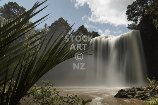
Gorgeous high waterfall of the Pakoka river with white water spray, near the start of the Pipiwharauroa walking track
Cox’s Beach hidden between Langs Beach and the Waipu Pancake Rocks

Route to Garratt Road, with bridge, Pohutukawa trees, rocks and beautiful native bush
Slow exposure of the beautiful and scenic 29 metre waterfall in Tikipunga, Whangarei, with a Nikau palm on the left.

View of the beautiful Te Kopua bridge connecting Raglan town with Kopua Recreation Reserve across the estuary

Big moody sandy dunes and native bush on the long beach near remote Pouto Point, at the southern mouth of Kaipara Harbour

Gorgeous 55 m high waterfall of the Pakoka river, near the start of the Pipiwharauroa walking and biking trail

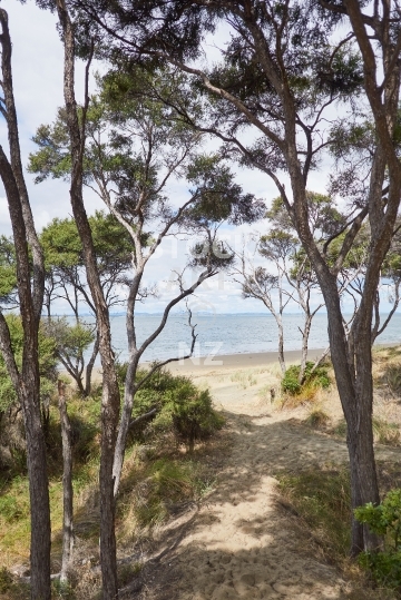
Tunnel of tea trees forming a pathway in native bush - Tutukaka Coast, Northland, NZ
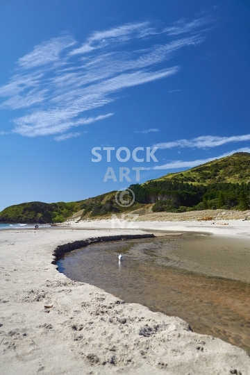
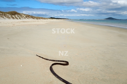
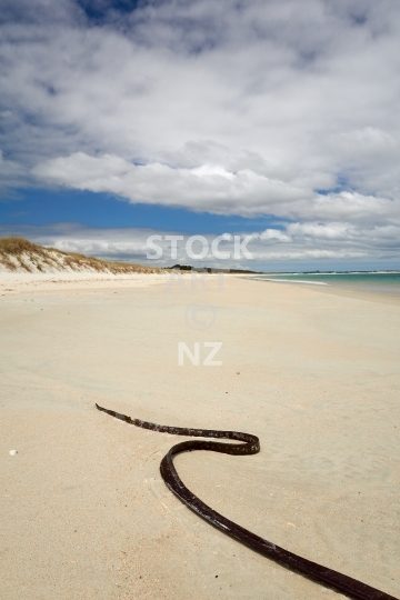
River stream meandering through the sand
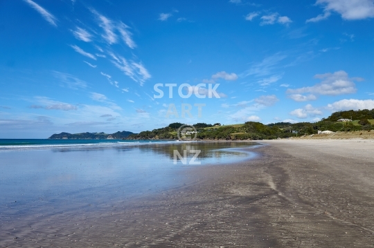
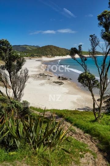
Beach behind the scenic reserve Whananaki coast camping ground

Big tourist boat waiting offshore - along the Te Ara Hura round the island coastal track near Matiatia Bay, with cabbage trees and flax bush

Headland, native bush and sea views along the Te Ara Hura coastal track that leads all around Waiheke Island

Boat sheds and boats seen from a walkway around the beach, lined with pohutukawa trees
Stunning and popular surf beach at low tide - Whangarei Heads, Northland, New Zealand
Looking south via magical rocks towards the giant sandspit in front of Mangawhai village

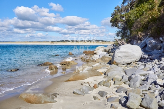
Beautiful hidden beach with volcanic rocks, along the Whananaki Coastal Trail, near the Bougainville Memorial

Birds flying on the endless beach, Pouto Peninsula, Northland, NZ

Inviting and beautiful walking track along the whole island coast

A magical tunnel of tea trees forming a pathway in native bush on the Tutukaka Coast, Northland

Closeup of the beautiful colourful rocks at the causeway between Tutukaka Headland and the lighthouse island

Walking track on the Tutukaka Headland, across the two sided beach causeway with its rock formations, towards the island with the lighthouse

Beautiful little village at the end of the road behind Russell, halfway up the walking track to spectacular Tapeka Point with a view over the Bay of Islands

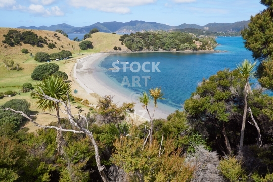
A beautiful lonely bay seen from a ridge along a walking track near the Whananaki DOC campground, with a view of Motutohe Island on the left

Limestone cave with Nikau palm in Dry Creek Valley
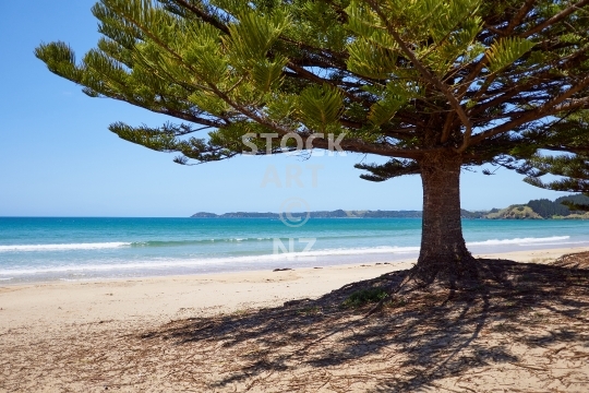
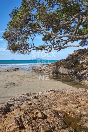
Shade from an iconic old tree planted by settlers and white sand on the south side of Whananaki

A beautiful lonely bay along the Motutara walking track
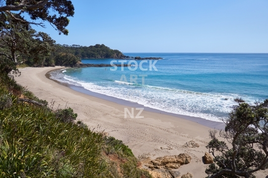
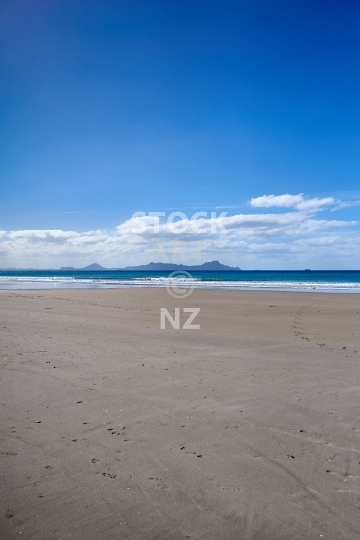
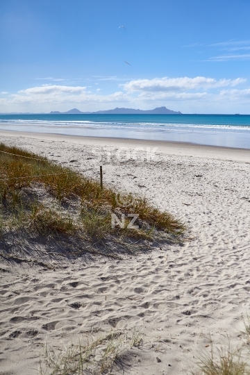
Beautiful and remote bay with pure white silicate sand and kelp
The endless beach at the southern mouth of gigantic Kaipara Harbour, walking towards the open west coast with cloudy blue sky above, sand dunes and native bush beside
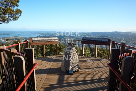
Whangarei’s local panorama viewpoint 241 metres above sea level, the platform has a carved kohatu rock as a symbol of the mountain’s mauri or life force
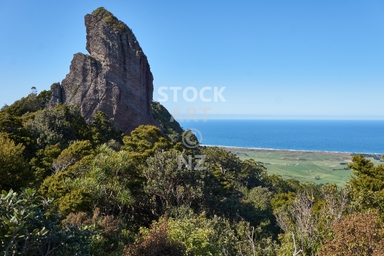
On the top of one of the beautiful Whangarei Heads volcanoes
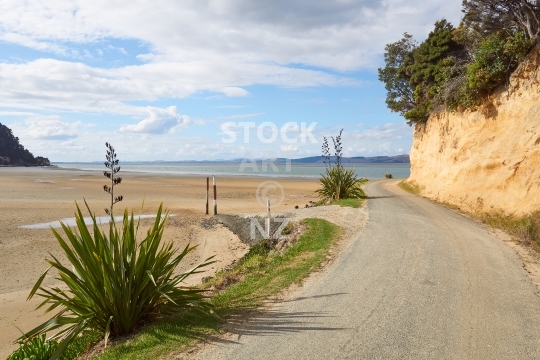
Coastal views into the harbour and golden cliff with flax bushes
The end of the road, of Kaipara Harbour and of Ripiro Beach

Coastal road and golden cliff with flax bushes
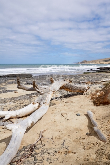
Wild west coast beach with giant sand dunes in the background
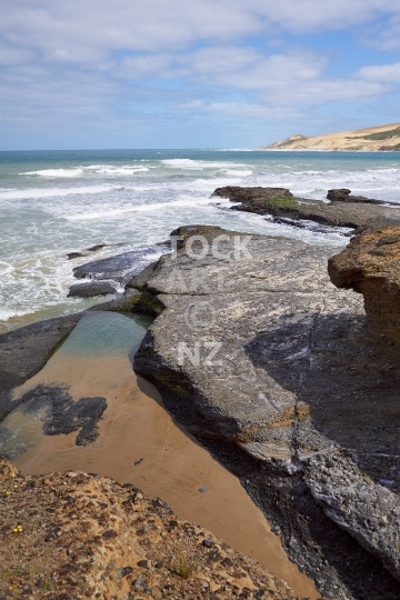
Rockpools with a view to the giant sand dunes
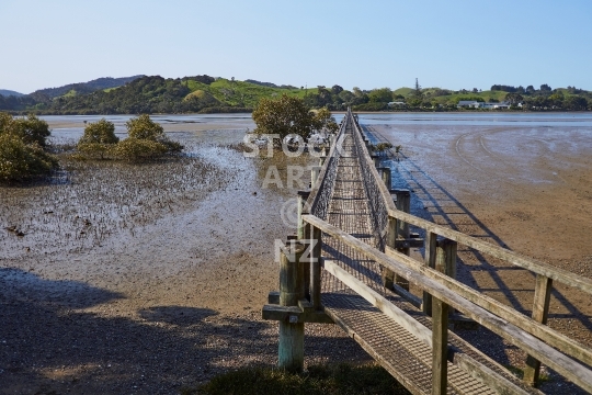
Lovely wooden bridge over the river estuary
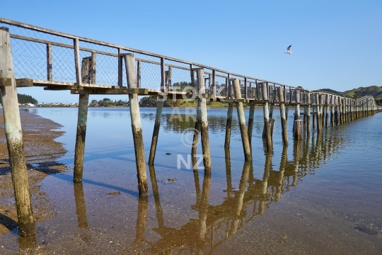
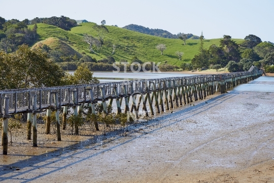
The longest walking bridge in the southern hemisphere - Northland, New Zealand


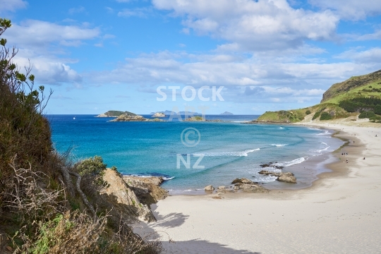
One of New Zealand’s most beautiful beaches in the Far North, Northland

Detail of the beautiful bascules reaching into the sky
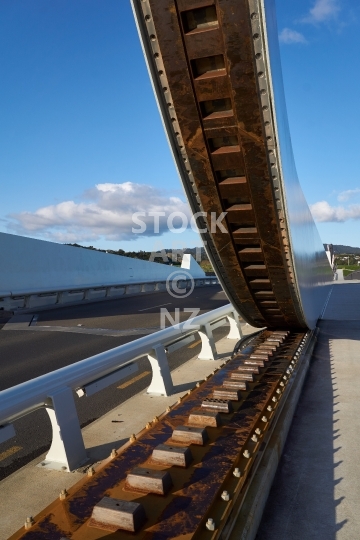
Detail of one bascule with draw mechanism
River estuary with rocks and Hen Island in the background

River estuary with rocks and Hen Island in the background
White sand at low tide and the Whangarei Heads in the background
White sand and the Whangarei Heads in the background

Whangarei’s main volcano over Kensington with rainbow at sunset

Portrait lookout through flax bushes - Northland, New Zealand

Extinct volcano with native bush scenic reserve, seen from Kensington with rainbow at sunset
Urupukapuka Bay Campsite - Bay of Islands, Northland
Portrait orientation photo

Black and white photo - The Fishhook of Pohe bridge across the Hatea river in the Town Basin

Te Matau A Pohe - The Fishhook of Pohe crossing across the Hatea river
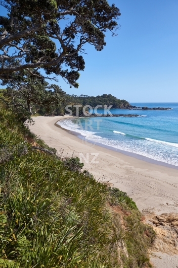
Beautiful white silicate sand and kelp - portrait orientation
Longest walking bridge in the southern hemisphere!


