Your Shopping Cart is empty.


Scenic boardwalk close to the city with two big kauri trees


Dolphin Place lookout near Whangaumu Bay, Whangarei, Northland, NZ


Whangarei Council owned park with walkways through bush and exciting limestone formations

Department of Conservation (DOC) sign

Intricate wooden house facade in Swiss mountain style

Traditional mountain architecture style full of ornaments and paintings

Closeup of an intricately painted and carved wooden chalet

One of the most beautiful Swiss chalets, in the Bernese Oberland, built 1777

Maybe the most beautiful Swiss chalet of all, built 1756, in the Bernese Oberland

Spectacular landscape view of Tutukaka Block Road houses and bays from Dolphin Place hill with its trig and viewpoint

Pathway to the small temple near Angkor, still overgrown under Khmer Rouge control and landmined beside the pathways - black & white vintage low resolution photo from March 1992

View of stunning Ocean Beach from a lookout - the wonderful Whangarei Heads surf beach on the Te Araroa Trail

Te Kopua bridge between Raglan and Kopua Recreation Reserve and pohutukawa trees, Waikato NZ

Route to Garratt Road, with bridge, Pohutukawa trees, rocks and beautiful native bush

View of the beautiful Te Kopua bridge connecting Raglan town with Kopua Recreation Reserve across the estuary

Big moody sandy dunes and native bush on the long beach near remote Pouto Point, at the southern mouth of Kaipara Harbour

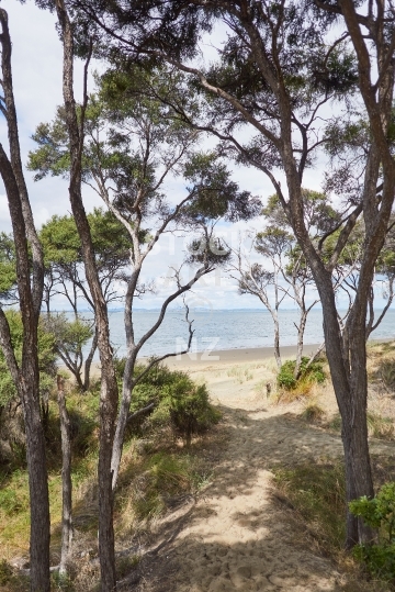
Tunnel of tea trees forming a pathway in native bush - Tutukaka Coast, Northland, NZ

Headland, native bush and sea views along the Te Ara Hura coastal track that leads all around Waiheke Island

Birds flying on the endless beach, Pouto Peninsula, Northland, NZ

Inviting and beautiful walking track along the whole island coast

A magical tunnel of tea trees forming a pathway in native bush on the Tutukaka Coast, Northland

Walking track on the Tutukaka Headland, across the two sided beach causeway with its rock formations, towards the island with the lighthouse
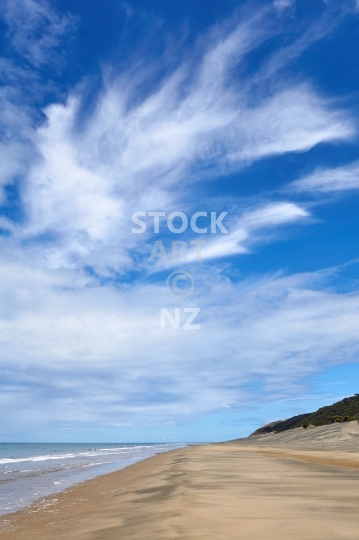
The endless beach at the southern mouth of gigantic Kaipara Harbour, walking towards the open west coast with cloudy blue sky above, sand dunes and native bush beside
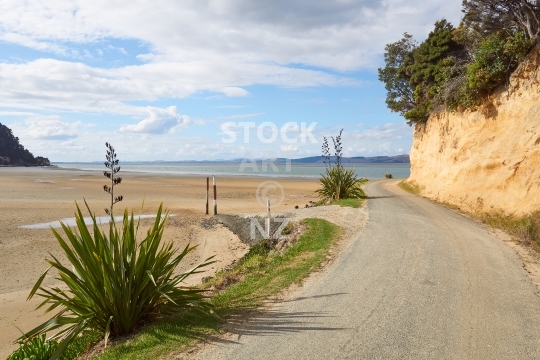
Coastal views into the harbour and golden cliff with flax bushes
The end of the road, of Kaipara Harbour and of Ripiro Beach

Coastal road and golden cliff with flax bushes
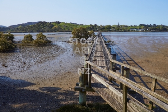
Lovely wooden bridge over the river estuary
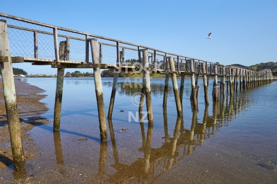
The longest walking bridge in the southern hemisphere - Northland, New Zealand
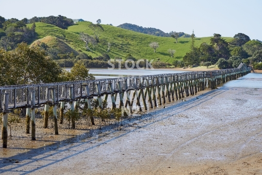
Longest walking bridge in the southern hemisphere!

Off to the beach - along the walking path in Ruakaka, Northland, NZ

Viewpoint on the Te Araroa Trail, New Zealand
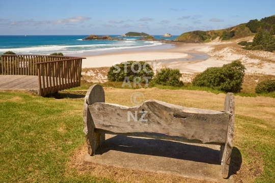
Viewpoint towards the beach with the _qt_Millenium Seat_qt_ bench

View of Ocean Beach from a lookout - a wonderful Whangarei Heads surf beach, on the Te Araroa Trail. Vertical portrait format.


